Innovation in Exploration
Date/Time: Monday, November 3 | (11:15 am – 12:15 pm)
Location: Embassy Room
EarthEx Geophysical: From Outcrop to Insight: Next-Generation Drones for Real-Time Subsurface Intelligence in Geological Field Programs
Session Overview:
Mineral exploration workflows often split geological mapping and broad geophysical surveys into separate phases. Both approaches are fundamental to discovery, however we believe eliminating this separation will improve maturation time of exploration projects. We propose that cross-trained field crews using reliable UAV platforms with automated processing to merge these paths will enable faster target generation, and adaptive surveying. Crews that execute and process targeted drone surveys on site in tandem with ground campaigns would reduce delays and accelerate mapping from rapid data returns, producing a more responsive exploration workflow.
A cross-trained team reduces the need to guess and check with geophysical data and multiple crews. Rapid magnetic, photo and LiDAR surveys can now be completed and treated with automated processing on areas slated for geological mapping and sampling by the same crew. Applications of this framework are broadened with multisensor payloads tailored to your exploration target.
The regulatory landscape is evolving. With the introduction of “Level 1 Complex Operations” certification on November 4, appropriately trained geologists and technicians will be permitted to operate UAVs in scenarios previously restricted. This change enables more dynamic crews and concurrent acquisition of geological and geophysical intelligence, each informing the other.
EarthEx is focused on accelerating discovery and delineation timelines for critical minerals and other commodities and is ready to operationalize this model. Our field technicians are cross trained in geological mapping and advanced UAV operations. Beginning in the 2026 field season, EarthEx plans to deploy integrated crews authorized for BVLOS operations performing geology, geophysics and geomatics campaigns simultaneously. Capable of collecting, processing and acting upon near-real- time subsurface intelligence that fuses outcrop observations with geophysical and geomatic context.
Dias Geophysical Session: Data Quality in Magnetotellurics: Controlling the Process
Session Overview:
The Magnetotelluric (MT) geophysical method measures natural electromagnetic field variations to image the electrical properties of the subsurface and is widely used in mineral exploration to map deep conductive/resistive structures. Ensuring consistent data quality from an uncontrolled source necessitates stringent control over the entire process, from field acquisition to final processing. Modern MT surveys follow careful and rigorous field procedures to leverage technology and software quality controls at all stages of acquisition as well as data processing for the computation of subsurface soundings and resistivity models. Advanced MT processing workflows should support the combined use of multiple data-derived and/or statistical quality features, such as: Coherence, Polarization Angles and Mahalanobis Distance, among others, to improve the signal-to-noise ratio though data weighting and noise rejection, together with robust regression algorithms. This is demonstrated through a comparative analysis between various industry/academic processing results. We discuss the future developments at both the hardware and software levels with a focus on integrated cloud storage, processing, and inversion services, as well as the advantages of a fully transparent MT processing ecosystem.
Speakers

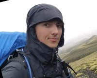
Tristian Leclerc, EarthEx Geophysical
Tristan Leclerc holds a BSc in Geology/Earth Sciences from Dalhousie University and works as a Junior Geological Field Technician and Drone Technician at EarthEx. He is presently enrolled in an MSc in Mechanical Engineering at the University of Manitoba, sponsored by EarthEx.

David Ernesto Quiroga Sánchez, Dias Geophysical
David E. Quiroga completed his MSc in Geophysics at the University of Alberta, Canada, where he conducted research on Global Geodynamics producing numerical models of the earths’ interior. Currently, he is member of the R&D team at DIAS Geophysical, and works in data science, software development and scientific programming, focused on the development/enhancement of computational tools and methods for geophysical signal processing. He is actively involved in the development of Magnetotellurics processing software and R&D in Airborne Geophysics. David has participated in national and international geophysical conferences such as the annual meetings of the American Geophysical Union and the Geological Society of America and has published his research in journals such as the Journal of Geophysical Research and the Journal of South American Earth Sciences.
Company Session: Data Quality in Magnetotellurics: Controlling the Process

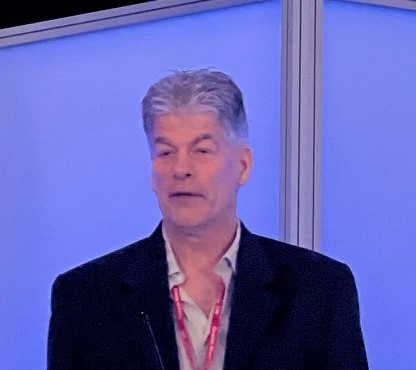
Chair: Claude Deveau
Claude Deveau (P.Eng) graduated from Technical University of Nova Scotia (now DalTech) with a Bachelor in Mining Engineering in 1987. Since 1988, Claude has been a mill operation Metallurgist, a Technical Manager, and more recently a Chief Metallurgist at Tantalum Mining Corporation. His work is well known in the global mineral processing community. A major highlight has been his design and implementation of unique processes for beneficiation/recovery of spodumene, tantalum and pollucite ores.
In 2013, Claude took the role of Site Technical Manager as well as reserve manager for the Tanco orebody. More recently, Claude took the role of Chief Metallurgist at Tanco. Claude is a team player who strives to provide technical support sitewide to the Tanco operation. He is committed to solving technical issues through innovation.
